
5 Best Hikes in San Diego
I lived in San Diego for six years and hiked most of what the county has to offer. Most lists will point you to Torrey Pines, Potato Chip Rock, or Mission Trails, and those are great starting points. But San Diego has a lot more to explore once you're ready to branch out. These five hikes are a little more challenging, a little less crowded, and worth the extra drive. Two of them cover segments of the Pacific Crest Trail, which I have a personal connection to as a board member of the Pacific Crest Trail Association.
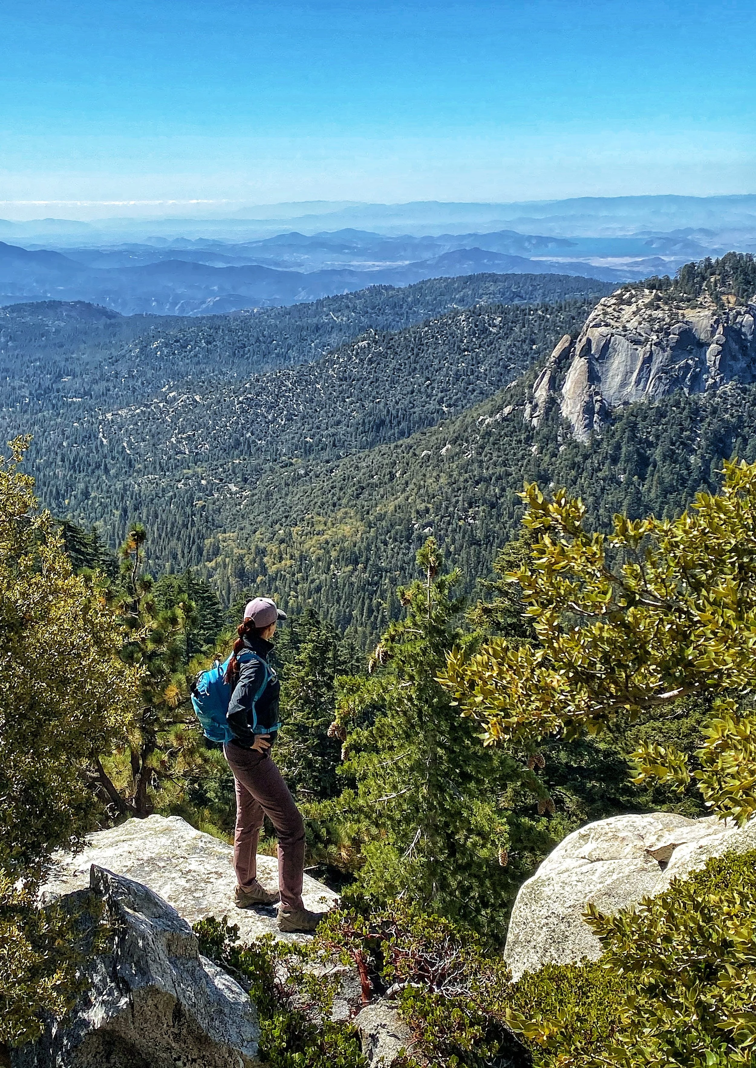
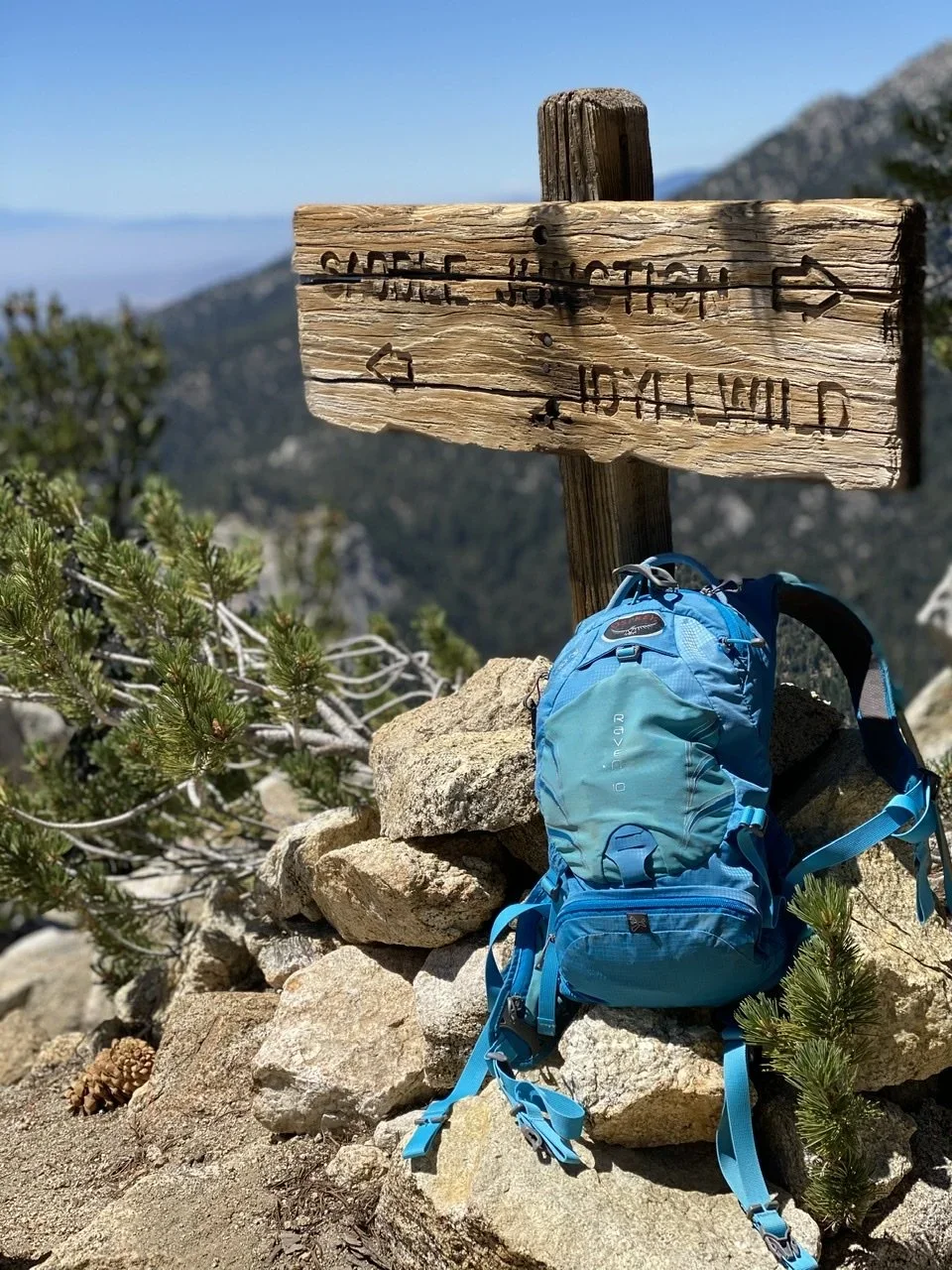
1. Tahquitz Peak via Devil's Slide
Tahquitz Peak is in the San Jacinto Mountains near Idyllwild, about a two-hour drive from San Diego. Technically Riverside County, but worth the trip.
You'll need a National Forest Adventure Pass to park at many trailheads in this area; day passes are about 5 dollars and are sold at most outdoor retailers like REI or Big 5, as well as through various online vendors. You'll also need a free wilderness day-use permit. Check the latest instructions from the San Jacinto Ranger District or Mount San Jacinto State Park, as permit procedures and pickup locations can change. They are typically available through ranger stations during business hours and sometimes via mail or online request.
The trail starts with a steep incline for the first 2.5 miles through a beautiful evergreen forest. If you're coming from sea level, give your lungs a minute to adjust. The terrain is composed of Mesozoic granite. Look for the grey rocks that sparkle in the sun. The closer you get to the peak, the more technical and steep it becomes.
The first stretch is moderately trafficked but thins out quickly as you climb. I've been here several times and never felt like it was overcrowded. At the top, a historic fire tower offers 360-degree views of the surrounding mountain ranges.
If you're hiking in summer, start early. The San Jacinto Mountains sit at significantly higher elevation than San Diego, so it stays about 15 degrees cooler, but the heat still builds in the afternoon. The trail starts around 6,300 feet and climbs above 8,000. This trail is often snow-covered and may be inaccessible or require winter travel skills from roughly November through March, so always check current conditions with the forest service before you go.
A note on distance: AllTrails and the posted mileage don't always match what I've clocked. I've done this one three times. The first time came out to 9.5 miles, and the second time I added the Caramba trail on the way back for just over 13. The Caramba connector is generally open but can be affected by snow, slides, or temporary closures, so verify conditions with the ranger district if you plan to add that extension.
2. Monument Peak and Foster Point
Located about an hour east of San Diego, this 6-mile out-and-back covers a segment of the Pacific Crest Trail. The trailhead sits on the backside of the Mount Laguna Recreation Area on the east side of Sunrise Highway. I love this hike because it overlooks a sweeping desert basin from a section of Mount Laguna that most people skip in favor of the more popular and more crowded trails on the west side.

There is almost no shade on this hike. In summer, it's brutally hot. Start early, bring more water than you think you need, and leave your dog at home if the forecast is above 75.
If you're here between late April and June, I recommend turning this into an 8.5-mile loop with about 1,050 feet of elevation gain by crossing Sunrise Highway and connecting to Sunset Trail and Big Laguna Trail after Foster Point. Start on the PCT side for the desert views, then cross over and finish through forest and a small lake. Late spring is the best time. Everything is green and the wildflowers are in full bloom, and as of the latest trail reports these connections are still intact and well-used.

Always check current notices from Cleveland National Forest for any temporary closures due to fire, storms, or maintenance before you go.
3. Eagle Rock via the Pacific Crest Trail
About 90 minutes from San Diego, this 6.5-mile out-and-back on the PCT features one of the most varied landscapes of any hike on this list. You start alongside a rambling, oak-lined creek through thick woods, then ascend through exposed chaparral before reaching rolling hills covered in silky grass.
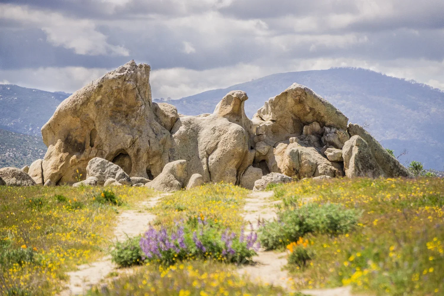
Photo Credit: Cheryl Garst
Local ranchers let their cattle graze in this open terrain, and you'll likely pass through gates and share the trail with cows along the way. They're not aggressive, but don't be surprised if a few follow you for a stretch.
The highlight is a large rock formation that wind has carved over time to resemble a raptor with outstretched wings, looking like it's about to take flight. It's one of those landmarks that earns its name.

This trail is generally hikeable year-round, but it gets cold in winter and dangerously hot in summer. My favorite time is spring or fall. Late April through May brings an excellent variety of wildflowers. As of the latest updates, this section of the PCT near Warner Springs has not been subject to any long-term fire closures, but always confirm current conditions if there's been recent fire activity in the region.
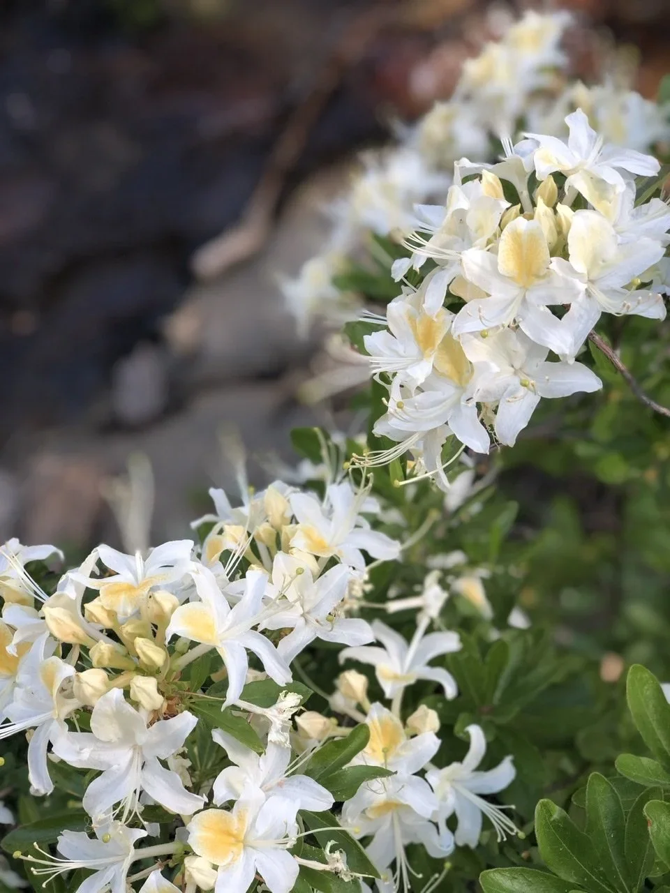
4. Cuyamaca Peak via Azalea Glenn Loop
Cuyamaca Rancho State Park is about an hour east of San Diego and home to some of the best hiking and mountain biking in the county. This 7.7-mile loop with about 1,800 feet of elevation gain is one of my favorite routes in the park, and it's accessible year-round.

The initial 1.5-mile ascent climbs through dense forest alongside a mountain creek. Keep an eye out for wild azaleas blooming near the water. If you come in fall, the leaves change here, one of the few places in San Diego County where that happens.
After that opening climb, you hit a challenging 2.5-mile technical segment along a ridge. Expect fallen trees, chunky granite, and very little shade. It's a workout. But the payoff is panoramic views to the east and west, including a stretch of wall trail with a steep drop-off. This section is lightly used. I've hiked it without seeing another person on the ridge.
The loop back to the trailhead takes you through grassy meadows, trees, and springtime wildflowers. There's a 10-dollar per-vehicle day-use fee at Paso Picacho. Bring cash or card, as payment methods can vary, and your receipt is good for day use in the park.
5. Hollenbeck Canyon in Jamul
The Hollenbeck Canyon Wildlife Area is a mixed-use area shared by hikers and mountain bikers, and it's one of the best-kept secrets in Southern California. I've been here more than any other trail on this list. It's also one of my go-to mountain bike spots.
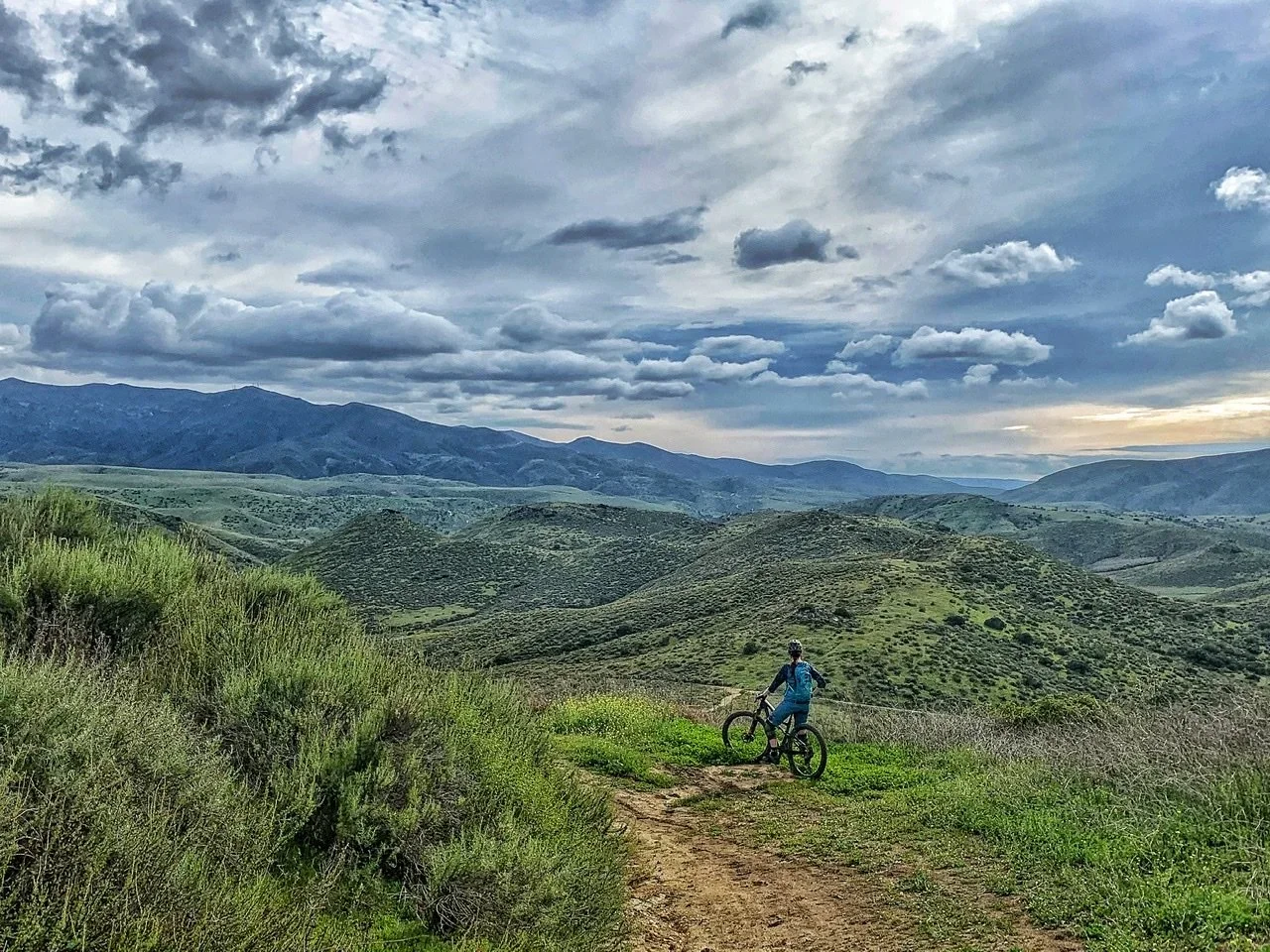
Cheryl overlooking the canyon.
You'll need a California Department of Fish and Wildlife Lands Pass for day use here. A small per-person fee (currently just under 6 dollars for a daily pass) is required for most visitors 16 and older, and passes can be purchased online, by phone, or wherever hunting and fishing licenses are sold.
My preferred route is a 6.2-mile loop that starts across a large rolling meadow and descends to a creek flanked with oak trees. Depending on winter rainfall, you may get wet at this crossing. It's the first of several on the trail. Shortly after the creek, you climb to an abandoned water tank that makes a good rest stop and photo opportunity.
The next 2.5 miles account for most of the 823 feet of elevation gain before a short, steep, rocky descent into a single-track trail with a deep plunge into the canyon. The scenery is excellent and there's always a breeze in this section.
For a longer day, you can extend this into a roughly 12-mile figure-eight loop with additional elevation gain. The extended network of trails here remains open and in regular use, but check current CDFW notices for any temporary closures or restrictions before heading out.